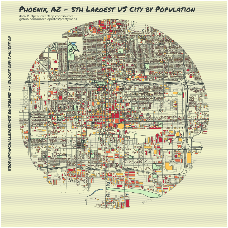
Day 5 -> Data Challenge 1: OpenStreetMap -> City: Phoenix
#30DayMapChallenge - November 5th
MAKE MAPS PRETTY
Well here we have arrived at Day 5 of the 30 Day Map Challenge. While I haven’t had a deliverable for each day, I’m pleased with my efforts on this site,
and the ever growing Data Exploration Notebook: 30 Day Notebook gist
Going with my original strategy for the 30 largest US cities, we have arrived at Phoenix, Arizona. This may come as a surprise to beat out cities like Philadelphia,
San Francisco and Dallas. This is where we might consider a deep demographic change analysis or comparisons, but let’s save that for another day (wikipedia has done our work for us).
Python Pretty Maps
In my never ending quest to produce beautiful maps with Python, I would like to try a library called Pretty Maps. This has popped up a few times in my feed and I
really like the look of the framed city maps that have been shared. It taps into the OSMnx library to access OSM data, so we hit our data challenge criteria.
Any wrapper on top of OpenStreetMap is a real bonus, as the APIs can be a bit obtuse if you haven’t used them before. You can check out the repo here:
prettymaps It's listed under a GNU Affero
General Public License v3.0 (you can make commercial use, distribute and modify this project, but must disclose the source code with the license and copyright notice).
Donate a coffee for the contributors to this open source project here:
Buy a Coffee for Marcelo Prates. I just did and it felt really great!
I started off exploring the Phoenix area with Leafmap, which has become one of my favorite methods for quick exploration of geospatial data with an interactive map. I followed the examples with Colab and prettymaps, using the recommended installs and imports, which involved restarting the runtime on your notebook, which is typical. Using leafmap I found the center point and bounding box coordinates for Phoenix, edited the text and radius, and was able to generate and export some very nice looking maps! A small amount of tweaking the text placement and experimenting with differing radius sizing and we’ve got a map for today.
First Attempt
.png)
Increased Radius
.png)
Today's Map

Stay Calm and Map On


.png)
.png)
